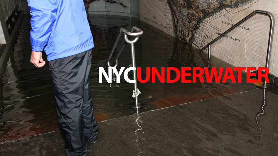
By Jesús Díaz
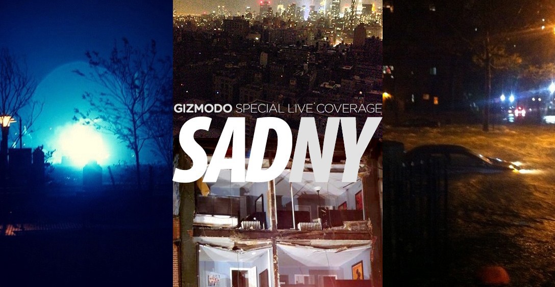
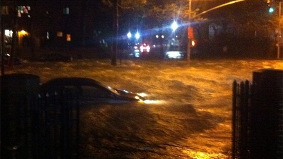
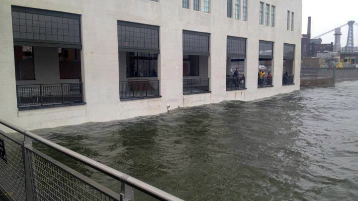
This time it was no hype. Sandy rampaged through New York, New Jersey and the rest of the Northeast. The damage has been enormous, including massive flooding everywhere, collapsed buildings, generator malfunctions in hospitals, multiple fires, city-wide blackouts and explosions in electric plants. Some of the subway system may be offline for a month. And yes, mortal victims too.
Gizmodo’s servers, located in a data center in Lower Manhattan, were knocked out too, but this article contains all the updates since the moment of the city shutdown. Refresh for live updates…
Sunday, November 4, 2012
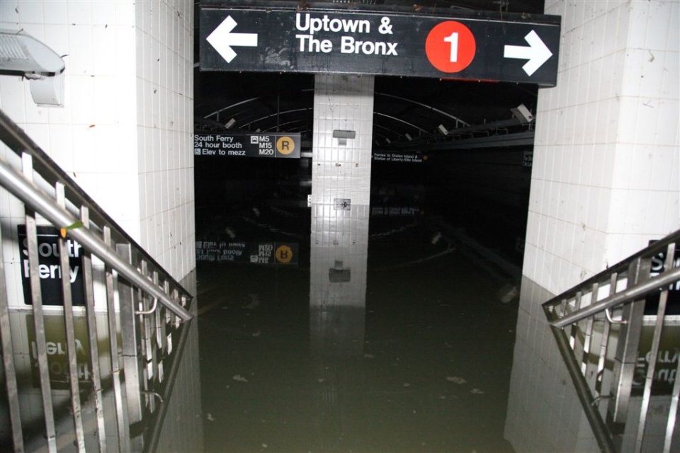
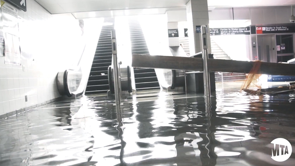
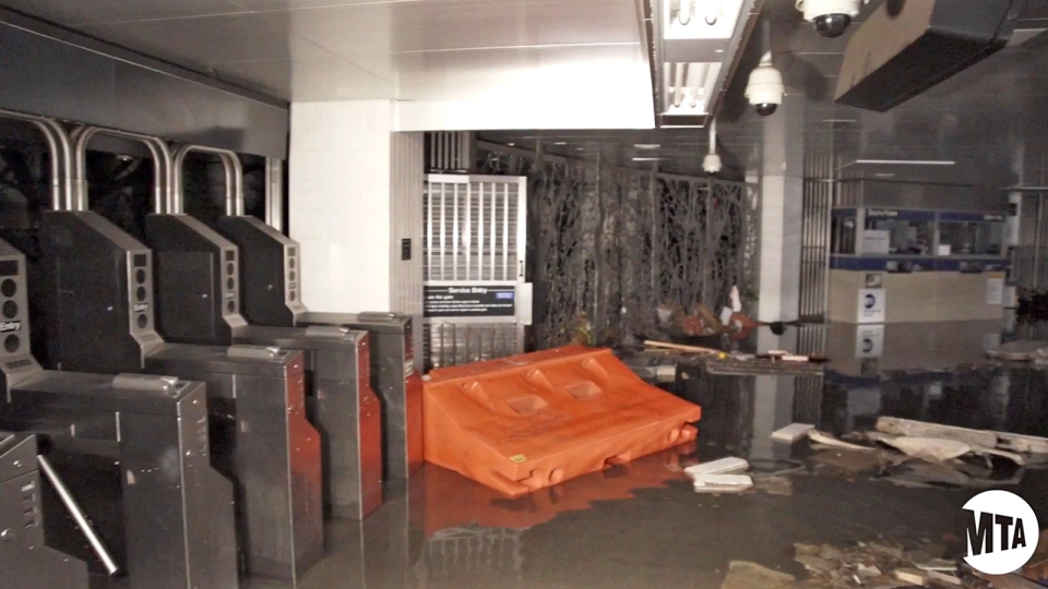
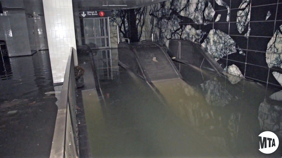
Update 71: The MTA reports that the South Ferry subway station is now completely dry.
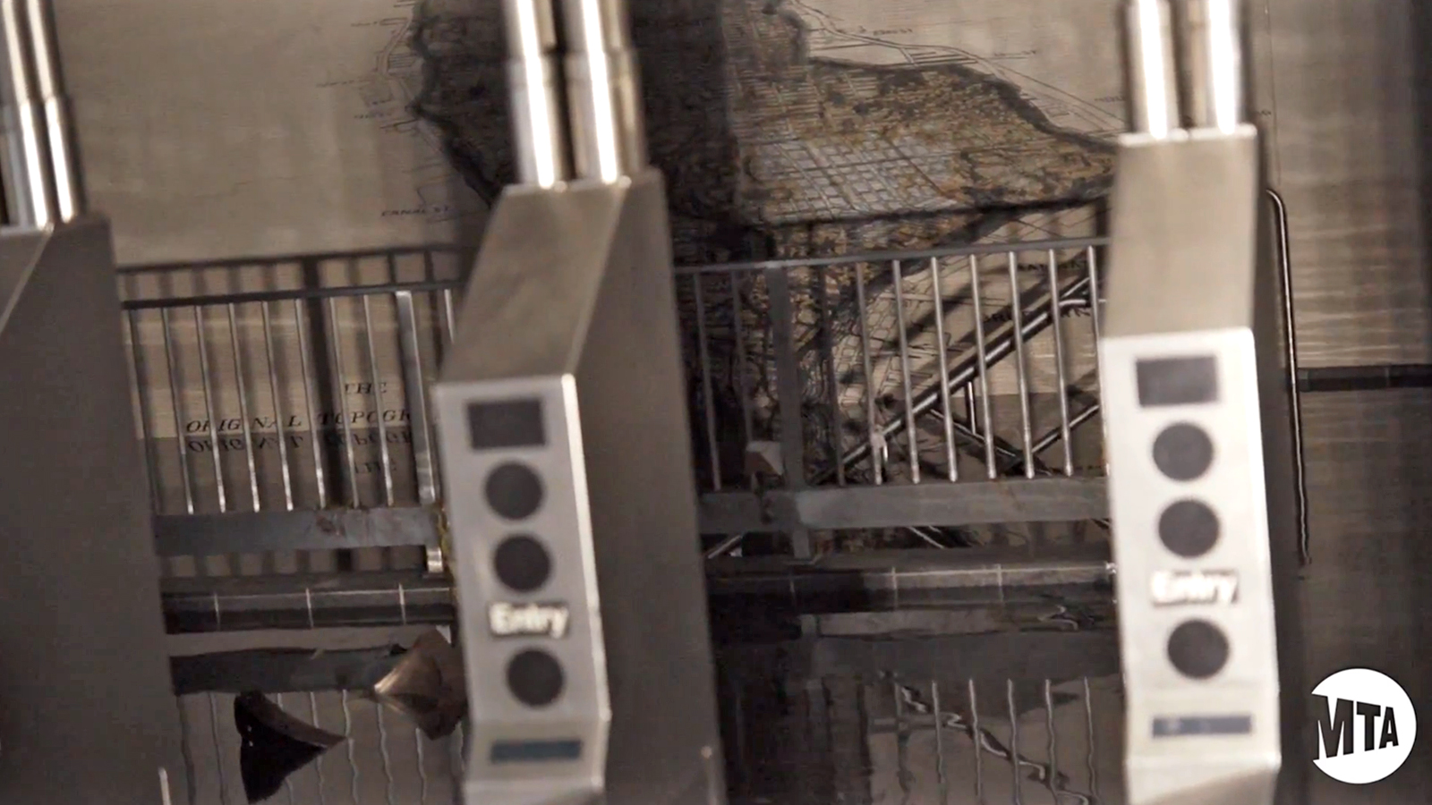
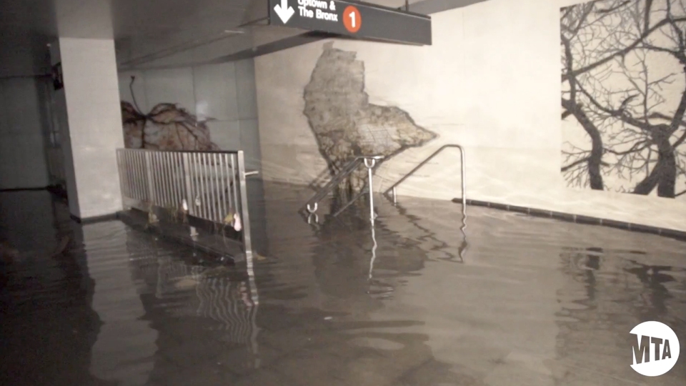
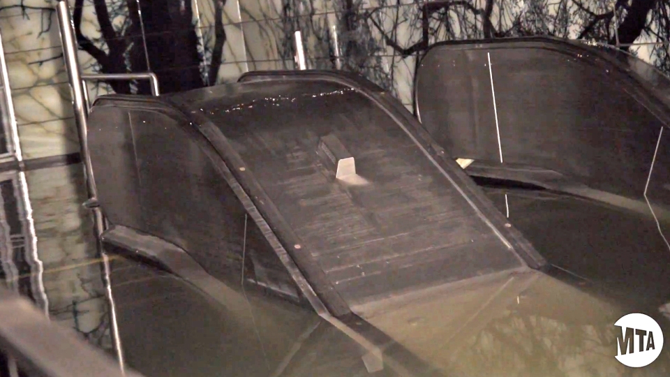
The South Ferry station, which had been a large fish tank, has now been pumped dry.
Saturday, November 3, 2012
Update 70: Con Edison has now restored power to 70 percent of the people affected by Sany.
Con Edison crews have restored electricity to more than 700,000 customers, or approximately 70 percent of all those who lost power since Hurricane Sandy slammed through New York. Nearly 950,000 Con Edison customers were affected by the storm.
Update 69: While most of Manhattan now has power, the situation is still bad in Staten Island, some parts of Brooklyn and New Jersey.
Update 68: The South Ferry subway station, which completely full of water up to its entrance, is recovering. Check out this image by the MTA:
Friday, November 2, 2012
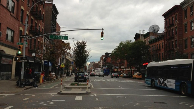
Update 67: It’s 4:58pm and power has been restored in the Lower East Side and Chelsea. People are cheering on the streets!
Seems like Con Edison is going to make it and the entirety of Manhattan will haver power today. I’ve never been so happy to see a traffic light!
Image of the 1st Avenue and 10th street taken a few minutes ago by Brian Thatcher.
This is really good news. It means that the subway power-up of many lines is also imminent. Sadly, this doesn’t mean that we are free from the blackout yet. Many people still need power in parts of New York and New Jersey.
Update 66: NASA has published a really good video summary of what caused Sandy. A must watch.
Update 65: Meanwhile, the city is giving food and water to those who need it most at different locations. You can check them out here (they are updating the list live).
Update 64: Other services are being restarted too, albeit slowly: Staten Island Ferry service was restored this morning The US Coast Guard reports on other maritime and river services:
- Manhattan and Bayonne cruise ship terminals are now open. The Brooklyn cruise ship terminal remains closed.
- Ferries and taxi services are operational on the Hudson and East Rivers.
- Port Jersey Channel is open.
- Gravesend Bay anchorage is open.
- The Hudson River is open to all vessel traffic.
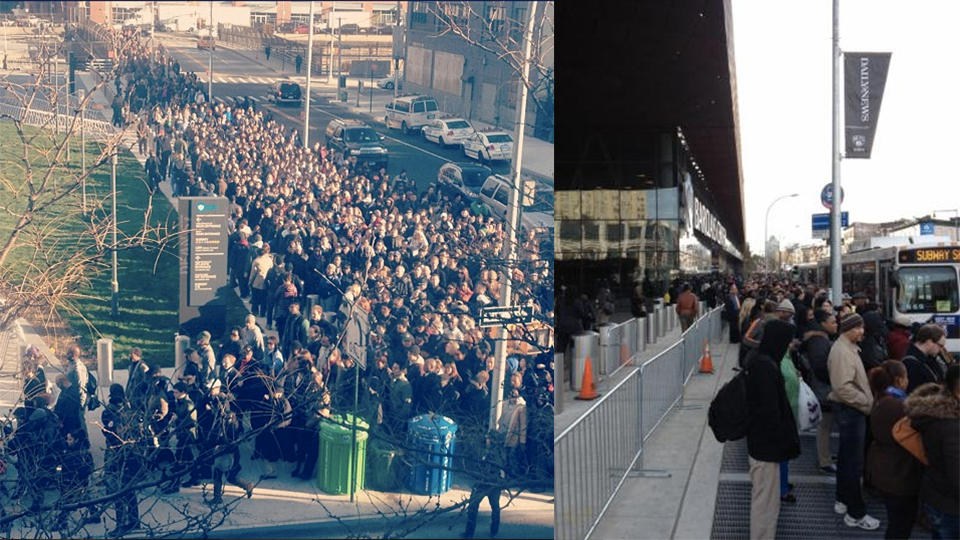
The lines are mind-blowing, as this photo taken by A. Southern shows:
Update 63: The situation is more or less the same as yesterday: mass lines for buses and gas stations and traffic jams. Con Edison keeps working to restore power in Lower Manhattan. Subway between Brooklyn and Manhattan may resume within hours, says New York’s Governor.
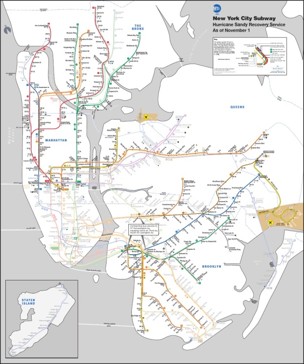
The MTA is hopeful that the No. 2, 3, 4 and 5 lines and trains that travel over the Manhattan and Williamsburg Bridges — the B,D,N, Q, J, M and Z will have Brooklyn-Manhattan service by day’s end, the Daily News has learned.
But, right now, this is what the subway situation looks like (see the PDF here):
Thursday, November 1, 2012
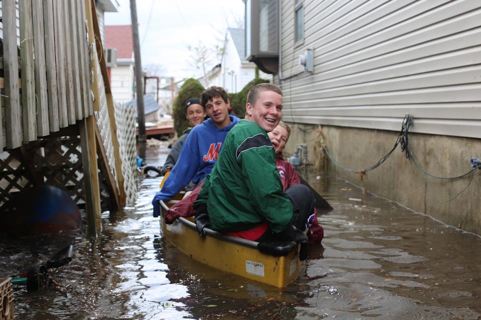
Update 62: Just a great photo of kids in New York. We’re moving forward. No further comment needed.
Update 61: Sadly, while Manhattan will be fully lit tomorrow or Saturday, some Con Edison costumers will not get power back any time soon.
They are saying ten more days of wait for “the vast majority” of customers knocked down by Sandy. Some will have to wait until the end of the month. Right now, the amount of unpowered customers is about 600,000, down from 850,000.
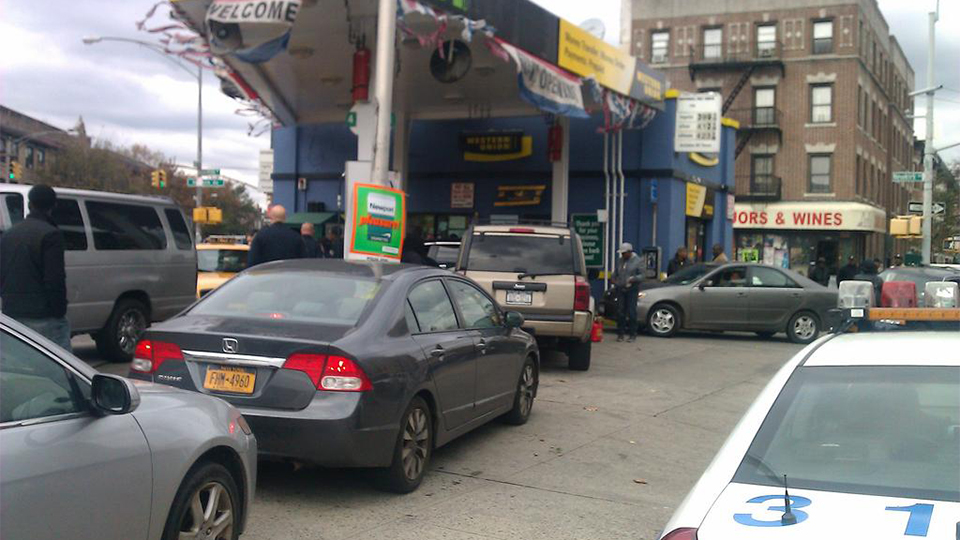
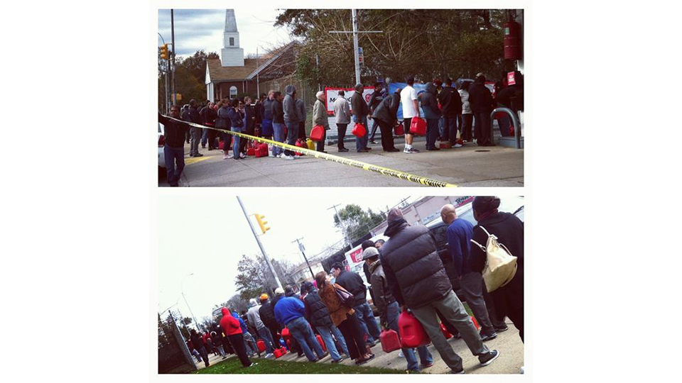
Update 60: The situation in gas stations is bad, as electricity have left pumps dead in many places. The traffic in and out of Manhattan is terrible too at rush hour.
“…another packed gas station. Police have to monitor them!” by James M.
“Line of people outside a #Queens #gasstation keeps on growing. Police directing traffic flow” by Alexa Mae Asperin.
Update 59: More good news—Con Edison is steadily reestablishing power through New York. All of Manhattan may be fully powered as early as tomorrow, Saturday at the latest.
Update 58: NYC is trying to return to normality, but things are hard. The public transportation is coming back to life but the bus lines at rush hour have been 3 to 4 hours, BetaBeat reports thanks to the subway situation.
Wednesday, October 31, 2012
Update 57: We have created a gallery exclusively dedicated to the severe floods in New York and New Jersey. Click here to see it.
Update 56: GREAT NEWS. The NYC subway is coming back online! Not all of it, though. Here’s the map:
(Very) limited subway service will be online starting at tomorrow morning. These are all the updates:
- R trains operate in BK btwn Jay St & 95th St making all local stops
- N trains operate btwn Ditmars Blvd. (Queens) & 34th St making all local stops
- F trains operate in 2 sections making all local stops: btwn 179th St (Queens) & 34th St | in BK, btwn Jay St & Ave X
- J trains operate btwn Jamaica Center & Hewes St mkg all local stops| M trains btwn Myrtle Ave-Broadway & Metropolitan Ave
- A trains will operate in 2 sections locally: btwn 168th St Manhattan & 34th St | btwn Jay Street & Lefferts Blvd.
- 7, B, C, E, G, Q train service is still suspended
- 7 trains suspended, 42nd St Shuttle S trains will operate btwn Times Square & Grand Central
- 4 trains will operate in 2 sections making all local stops btwn Woodlawn (Bronx) & 42nd St, btwn Borough Hall & New Lots Ave
- 5 trains will operate express in BK between Atlantic Ave-Barclays Ctr & Flatbush Ave
- 6 trains will operate local between Pelham Bay Park & Grand Central-42nd St
- 2 trains will operate between 241st Str (Bronx) & Times Square-42nd St, w express service btwn 96th St & Times Square
- 1 trains will operate local between 242nd Street (Bronx) and Times Square-42nd Street
Update 55: Fire, wind and water.
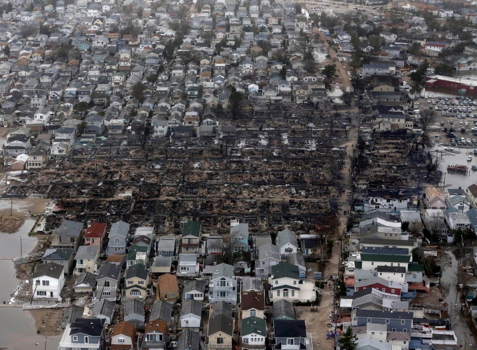
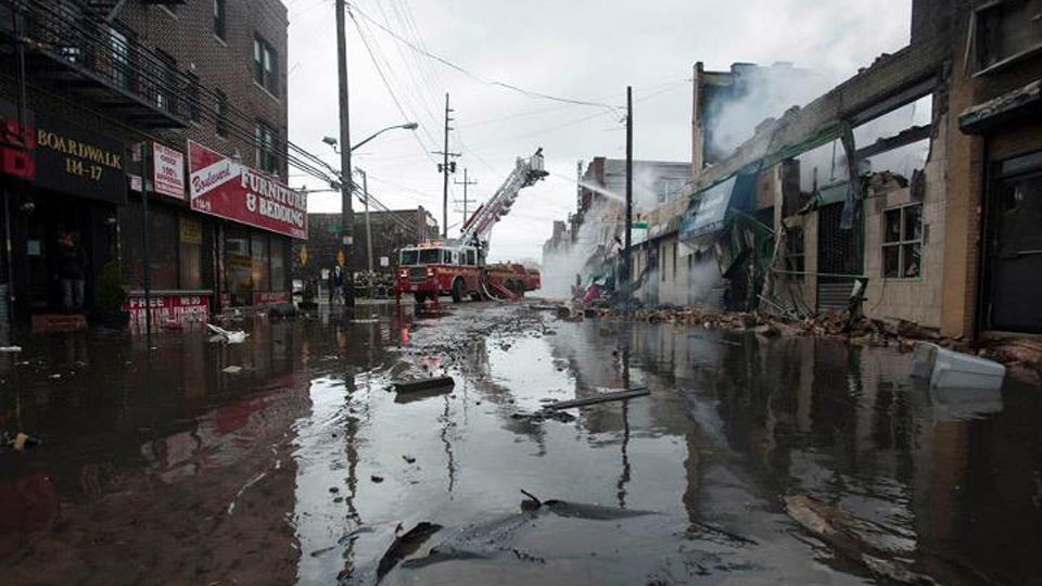
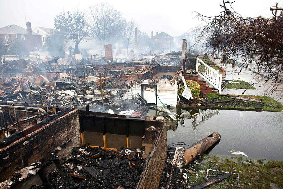
Fire destroyed 110 homes in Breezy Point, Queens. Multiple fires happened through NYC and other cities during and after Sandy. (AP)
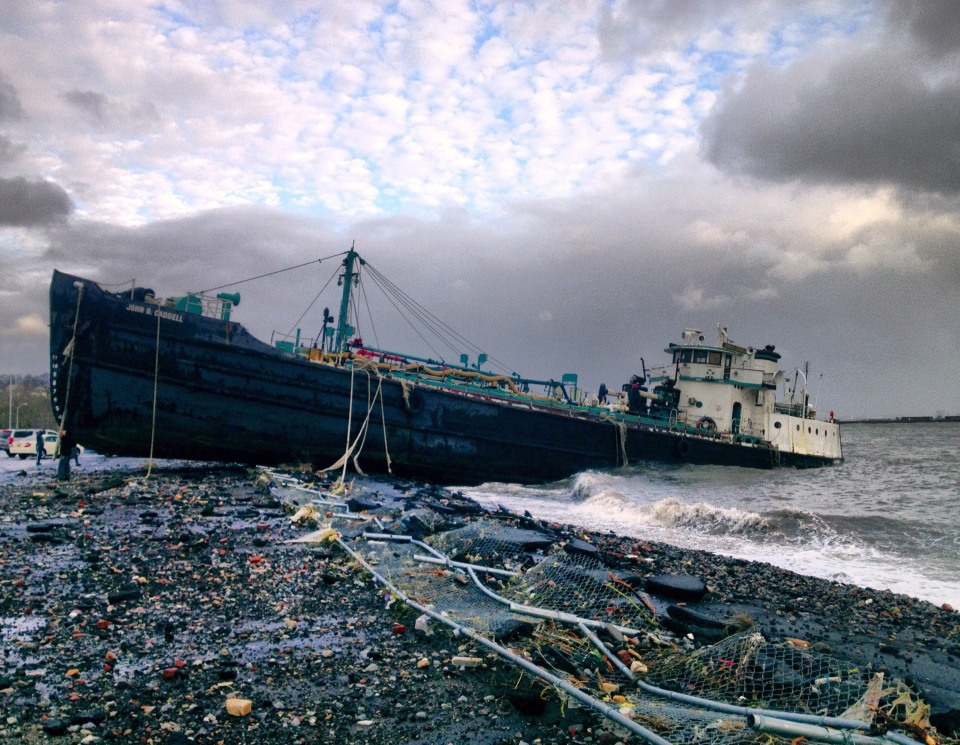
Heavy winds pushed several ships to the coast. (AP)
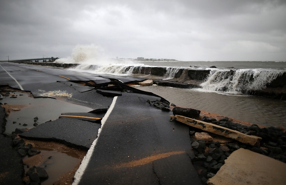
The force of water destroyed infrastructures and flooded the NYC Subway and other areas. (Getty)
Update 54: Here’s the full timelapse of Sandy as it went through NYC. You can see the city lights going down
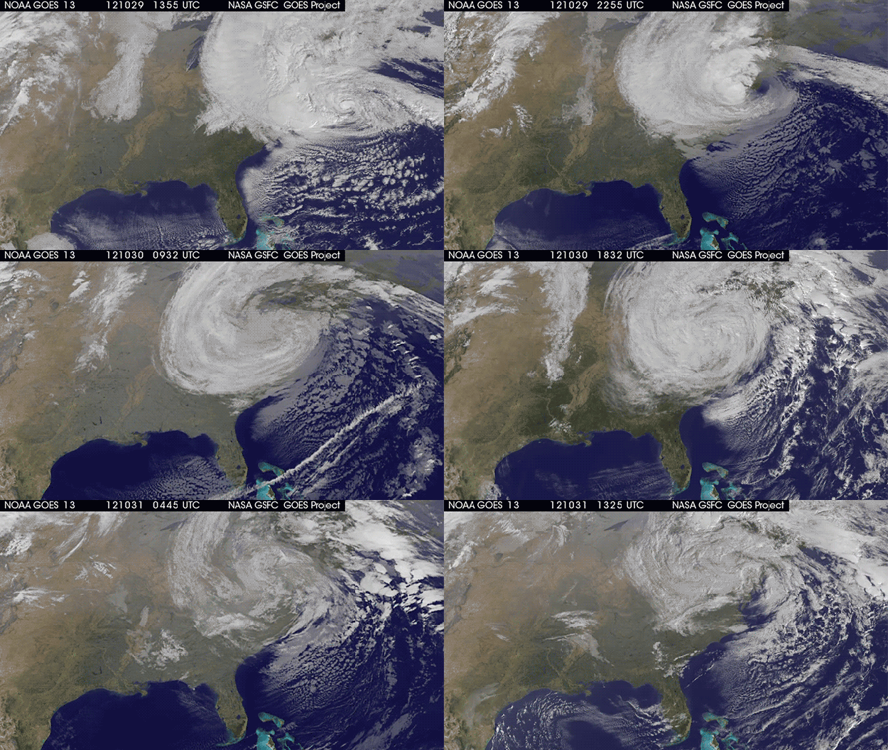
Update 53: Sandy’s furious attack and disintegration
The latest video from NASA/NOAA GOES-13 satellite shows Sandy from Monday, October 29 at 9:55am EDT—as it was ramping up to attack New Jersey and New York—to October 31, 10:02am EDT, just a few minutes ago. You can clearly see all its fury and how it’s been disintegrating during the past hours. Here’s the full video:
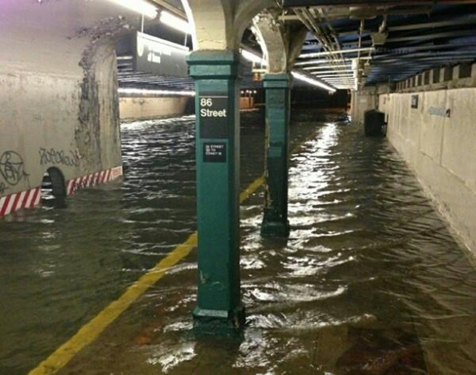
Update 52: Another photo of a subway station flooded. Unlike the South Ferry and Whitehall Street station, the 86 street one is only partially flooded
Update 51: The NYC subway is still offline, but bus lines are coming back to life. The MTA just posted this a few minutes ago
NYC Transit and MTA Bus continue efforts to restore service following Hurricane Sandy. Bus service will operate on a fare-free basis today.
Local, Limited-Stop and Express Bus service will operate as close to a normal weekday schedule as possible today.
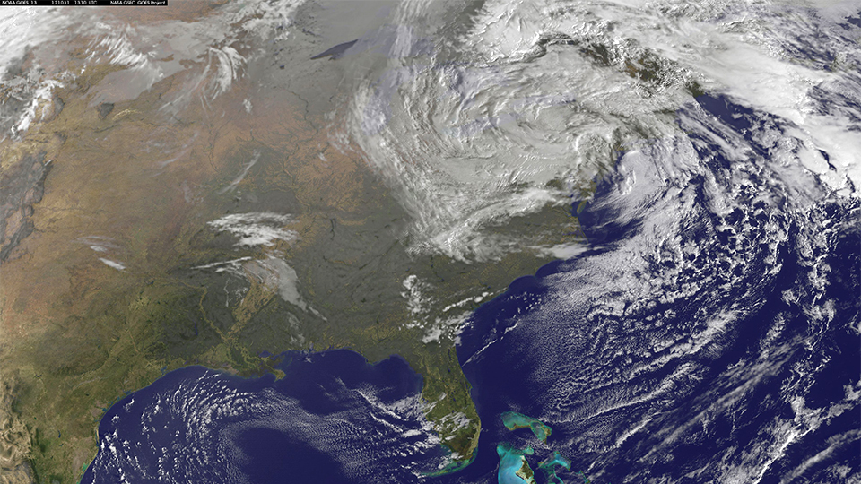
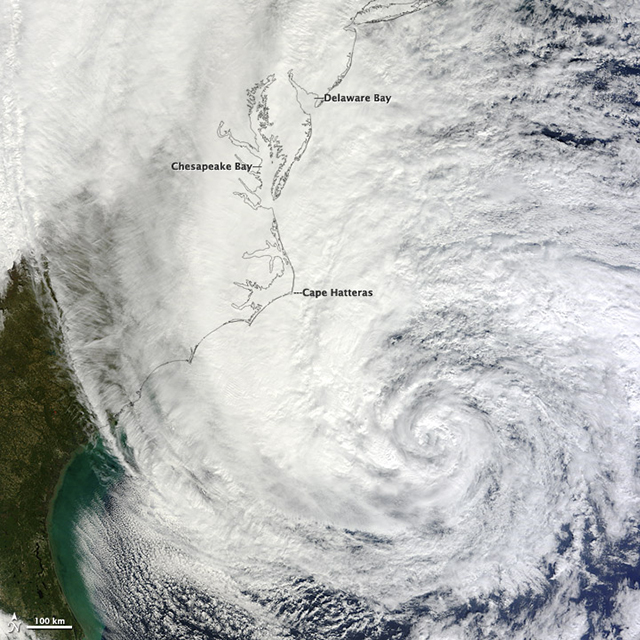
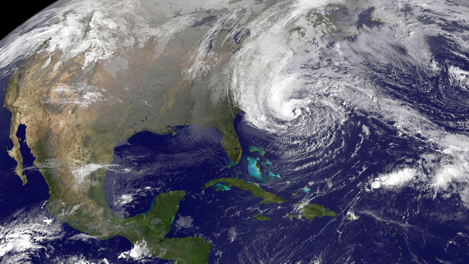
Update 50: Some good news: Sandy is dying, according to NOAA. Here’s a picture taken by NASA/NOAA GOES-13 satellite at 9:10am EDT
AT 0500 AM EDT…0900 UTC…THERE WAS NO DISCERNIBLE SURFACECIRCULATION FOR THE REMNANTS OF SANDY. SANDY HAS WEAKENED INTO ASURFACE TROUGH OF LOW PRESSURE OVER WESTERN PENNSYLVANIA.
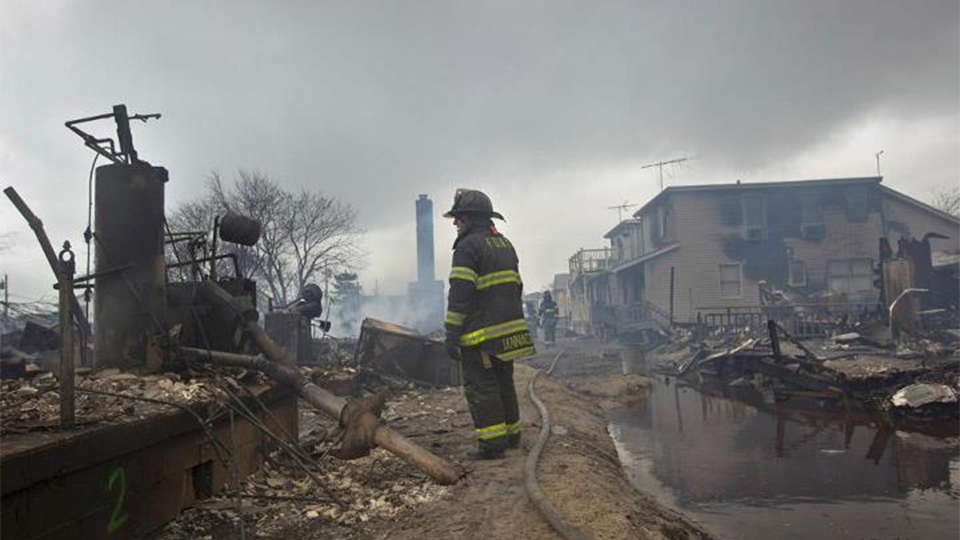
Update 49: The FDNY has reported the official count of houses “burned to the ground” in Breezy Point, Queen: 110 homes. Here are some photos from there, just published by the FDNY
Update 47: There are new fires in Brooklyn and Staten Island, according to the FDNY
Staten Island *75-0833* 430 Ocean Ave Dv8 reporting fire in a 75×35 P/D Partial collapse now forcing exterior operation
Brooklyn *75-1426* 3rd Ave & 25th st fire in 1 story 50 x 100 shed with haz mat equip, marine units operating also – fire is pwh and u/c
Brooklyn 2nd Alarm *22-3610* 706 Brighton Ave. Dv20 requesting 2nd Alarm for a heavy fire through the roof of a 20×50 2 Sty building.
Tuesday, October 30, 2012
Update 46: The Long Island Rail Road tunnel getting flooded by Sandy.
Update 45: These images of the MTA Subway show the extend of the flooding. There are stations which are completely submerged.
The sad thing is that we knew about this, the MTA technicians knew about what could happen, and
we told you about it on Monday:
On a rainy day, the pump system is absolute chaos, to the point where the MTA—NYC’s Metropolitan Transportation Authority—lives in permanent panic, fearing events like Sandy every year. “At some point, it would be too much to handle,” said the head of the hydraulics team back in 2006, Peter Velasquez Jr., “you’ve got rain plus wind. It basically would shut down the system. You hope not. You pray that it doesn’t.
“To give you an idea about how bad this could be, some of the oldest pumps in the NYCTA system were bought second-hand from the builders of the Panama Canal. I worked for the TA many years ago and even then the pumps were considered a serious problem. The Panama Canal was finished in 1914.”
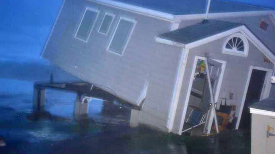
Update 44: Sandy, which is 1,000 miles wide according to NOAA, is also hitting Rhode Island
<em>”House off foundation due to storm surge on Row Carpenter Beach in Charlestown, RI.” by the <a href=”https://twitter.com/NWSBoston/status/263086708579508225/photo/1″>NWS</a>.</em>
Update 43: 7,400 National Guard members are now in the field.
National Guard assistance to local first responders and the Federal Emergency Management Agency included support at evacuation shelters, route clearance, search and rescue and delivery of essential equipment and supplies.
Guard members were assembling and staging in Connecticut, Delaware, Maryland, Massachusetts, New Hampshire, New York, North Carolina, Rhode Island and Virginia, according to the National Guard Coordination Center, which monitors the response spearheaded by the states.
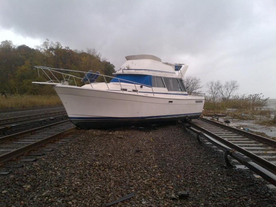
Update 42: Boat on the Metro-North tracks at Ossining, in Westchester County, New York,
Things are bad north of New York City too. Strong wings put this boat on the Metro-North tracks at Ossining, in Westchester County.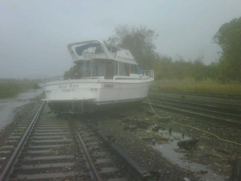
Update 41: Images and videos of the aftermath through New York and New Jersey
Watch one of the many trees falling.
This is how some of the fires started in Queens, New York. Video by Tina Amini. Read her story here.
This video of Atlantic City’s boardwalk really shows the scope of the destruction. Some blocks are completely gone.
Breeze Point after the fires.
Monday, October 29, 2012
Update 40: Terrifying video of the sea invading a residential area in Ocean City, New Jersey, just published by CNN
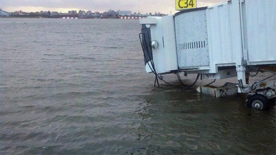
Update 39: Check out this photo from LaGuardia Airport, completely flooded.
“Glad I made it out of NYC Sunday at 11 pm on last AA flight out! Picture from LGA today by JetBlue ” by Vincent Laforet.
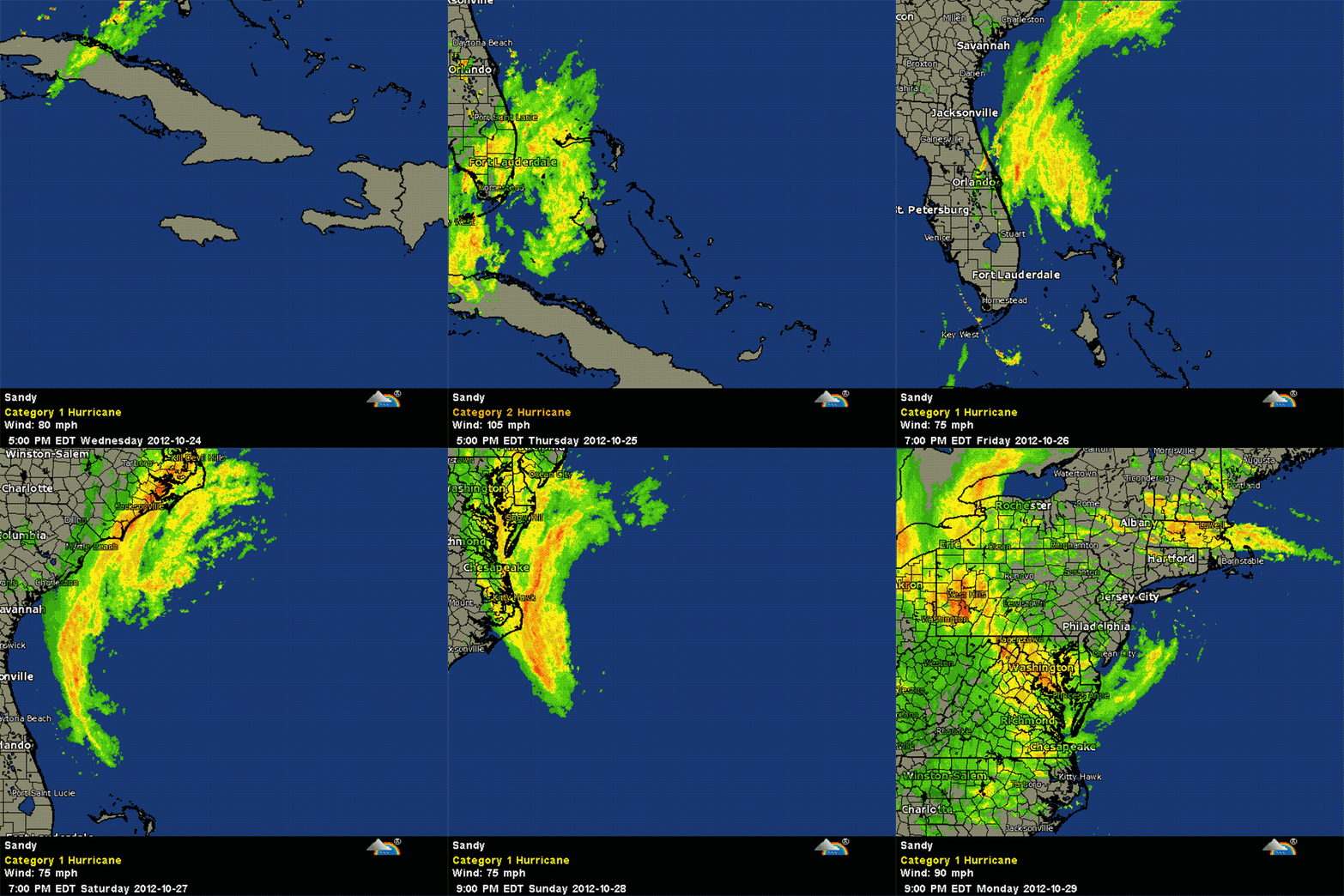
Update 38: Complete radar evolution of the storm by Weather Underground
Update 37: According to NOAA’s 11:00pm EDT update, Sandy’s center is moving through Pennsylvania, and is 10 miles from Philadelphia. It will go up to western New York on Tuesday night.
AND NORTHEAST IS FORECAST TUESDAY NIGHT. ON THE FORECAST TRACK…THE CENTER OF SANDY IS EXPECTED TO MOVE ACROSS PENNSYLVANIA DURING THE NEXT DAY OR SO…THEN MOVE INTO WESTERN NEW YORK TUESDAY NIGHT.
MAXIMUM SUSTAINED WINDS ARE NEAR 75 MPH…120 KM/H…WITH HIGHER GUSTS. THE STRONGEST WINDS ARE OCCURRING OVER WATER TO THE EAST OF THE CENTER. STEADY WEAKENING IS FORECAST DURING THE NEXT 48 HOURS.
Update 36: Oyster Creek nuclear plant has declared an alarm at 9:00pm, as water levels increase.
The U.S. Nuclear Regulatory Commission is continuing to monitor impacts from Hurricane Sandy on nuclear power plants in the Northeastern United States, including an Alert declared at the Oyster Creek nuclear power plant in New Jersey. The plant, currently in a regularly scheduled outage, declared the Alert at approximately 8:45 p.m. EDT due to water exceeding certain high water level criteria in the plant’s water intake structure.
There’s no plan to shut down the plan, as water levels are expected to recede. You can read the official document here.
Update 35: A light of hope
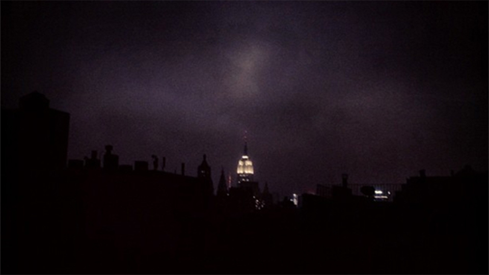
The Empire State is the only light in the sky by Idan Coeh.
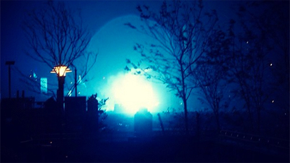
Update 34: The electric plant on 14th street exploding, taken from Williamsburg, Brooklyn, across the East River
“14th St Transformer exploding across the river from us” by George Weld
Update 33: Images of damage through New York City and New Jersey
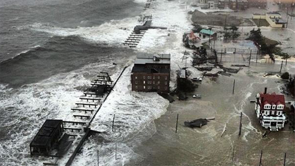 The Atlantic City Boardwalk has been completely obliterated
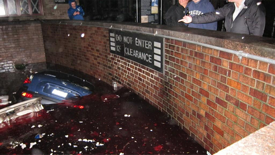 “Just took this photo of cars floating in the submerged parking garage at the South end of Stone Street” by Ray Wert
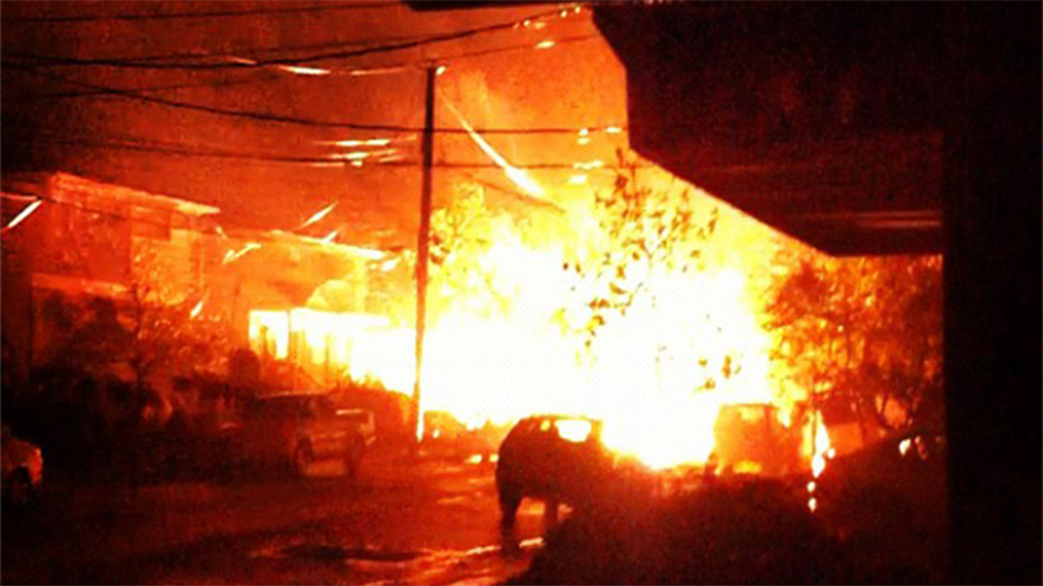
“Explosions down my block. Thank you Sandy #bitch” by Joey Geritano
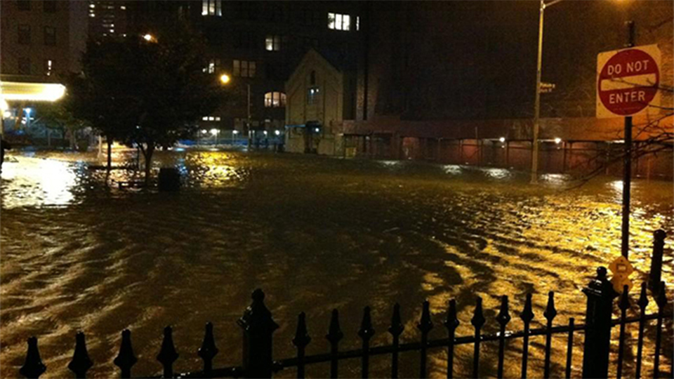 DUMBO, Brooklyn, flooded–and the tide is not high yet. It’s going to get worse
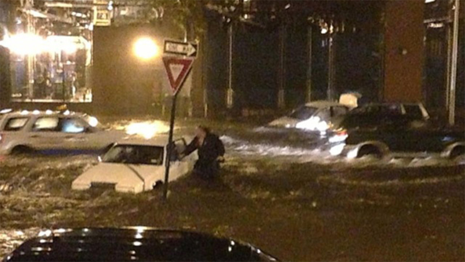 “14th Street and Avenue C in Manhattan” by Occuweather
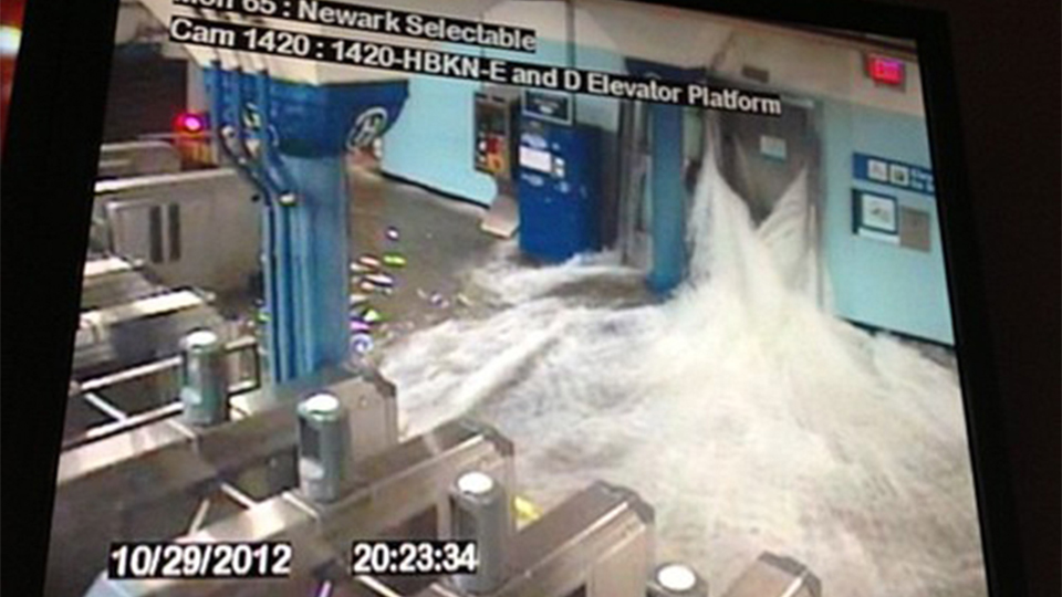 Hoboken E and D elevator platform
Update 32: Bellevue hospital’s generators have failed, according to the FDNY emergency dispatch radio
Update 31: ConEdison shut down several grids around the city. At one point most of the city was dark except a few structures, including the Empire State Building
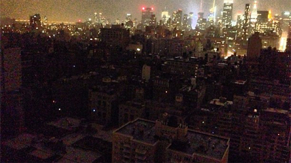 “And the lights go out in the Village.” by Eric Summers
Update 30: Video and images of the collapsed building on 14th Street and 8th Avenue
Video of the collapse
Video of the aftermath
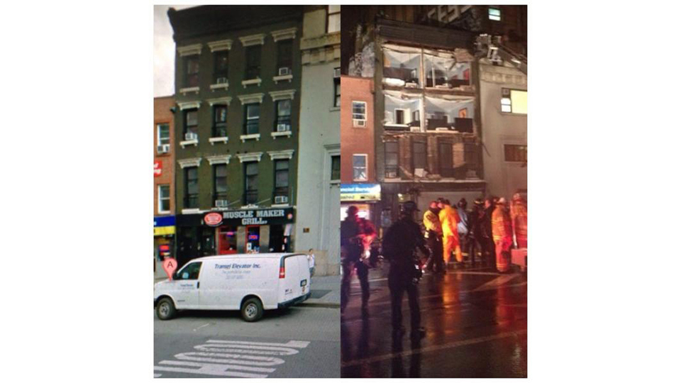 “Here’s a before/after of the collapsed building on 14th st” by Lucky Lefty Art.
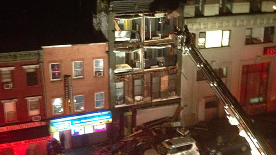
Collapsed building by Patti Sonntag
Update 29: Video of the crane on the skyscraper on West 57th Street collapsing
Update 28: The water levels keep increasing. This is how it looks now in Williamsburg’s riverside, in Brooklyn
“Across the East River, North 3rd and Kent Street at 5:00pm EDT” by Yale Yng-Wong
“To evacuate or not to evacuate that is the question—at 184 Kent.” by Deevee Kashi
Update 26: NOAA’s latest update at 5:00pm EDT: “Sandy is moving quickly toward southern New Jersey and Delaware. Landfall is expected early this evening accompanied by life-threatening storm surge and hurricane force winds.”
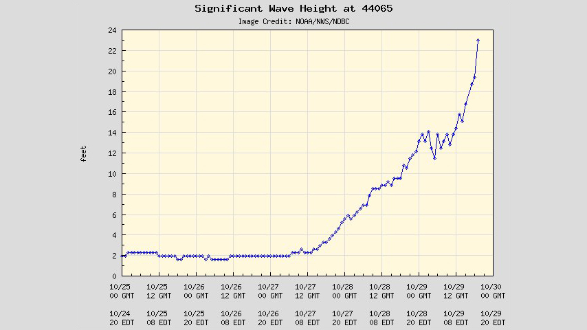
Update 25: 23-foot high waves reported at the entrance of the New York Harbor
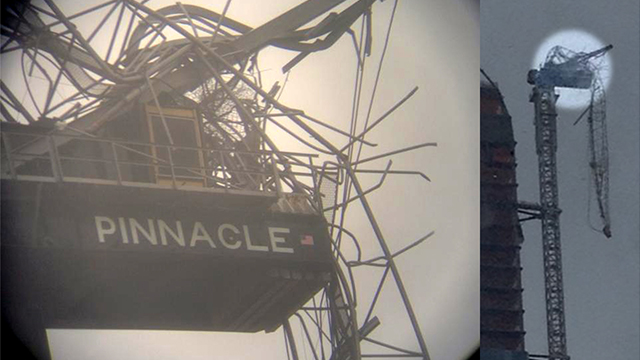
Update 24: Close-up on collapsed crane on skyscraper located at West 57th Street and 6th Avenue
“View of crane through a telescope.. It’s already broken off and is def going to fall” by Chris Wade
Update 23: Some last minute advice.
If the power goes off, remember that you can access the internet via text message to get the latest alerts. Here’s how to do it. Remember to have all your gadgets and batteries fully charged.
If you have dogs, here’s a guide on what to do with them and which shelters accept pets.
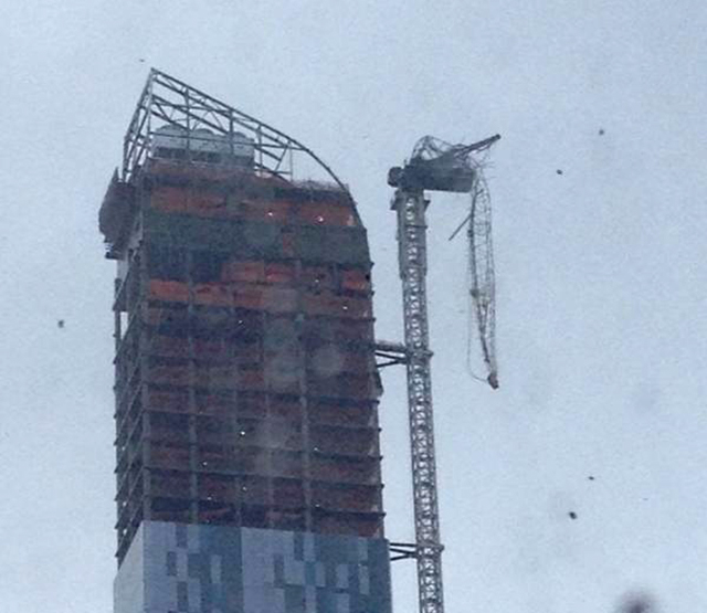
Update 22: A crane has collapsed in a Manhattan skyscraper on West 57th Street and 6th Avenue. FDNY is responding to the threat right now.
“Damaged, dangling crane atop (for now) 1 57th Street NYC” by Jonathan Wald
Update 21: Progression of Sandy as it approaches “more quickly” to New Jersey shore. The situation there is worsening by the minute.
NOAA’s National Severe Storms Laboratory says that blizzard conditions will happen as Sandy meets with the cold system coming from the great lakes.
Update 20: The view from the International Space Station taken this morning
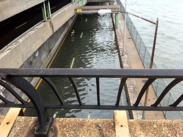
Update 19: FDR flooded
Latest Hurricane Sandy Satellite Photos and Videos (Updating Live)”This is the FDR Drive. It is underwater” by Mike Ryan.
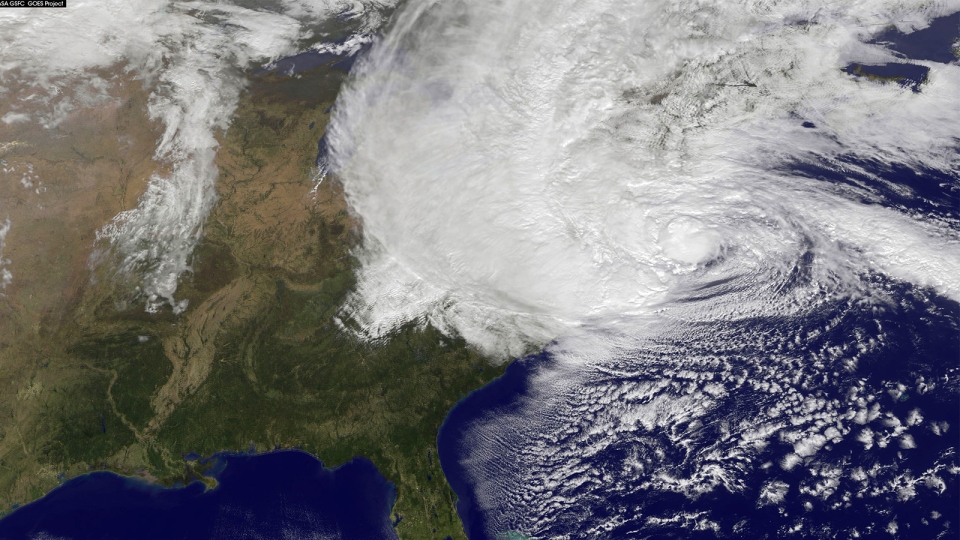
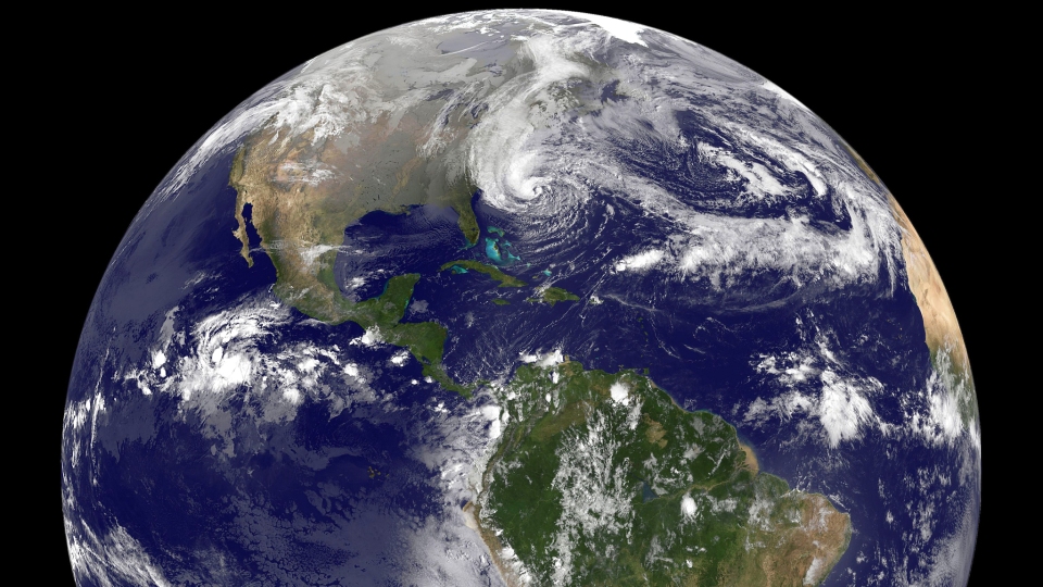
Update 18: NASA/NOAA GOES-13 image taken at 11:32AM EDT
Update 17: Latest NOAA update, at 11:00AM EDT
Hurricane-force winds are expected from Chincoteague, Virginia to Chatham, Massachusetts.
AT 1100 AM EDT…1500 UTC…THE CENTER OF HURRICANE SANDY WAS LOCATED NEAR LATITUDE 37.5 NORTH…LONGITUDE 71.5 WEST. SANDY IS MOVING TOWARD THE NORTH-NORTHWEST NEAR 18 MPH…30 KM/H. A TURN TOWARD THE NORTHWEST IS EXPECTED SOON…FOLLOWED BY A TURN TOWARD THE WEST-NORTHWEST TONIGHT. ON THE FORECAST TRACK… THE CENTER OF SANDY IS EXPECTED TO MAKE LANDFALL ALONG OR JUST SOUTH OF THE SOUTHERN NEW JERSEY COAST THIS EVENING OR TONIGHT.
REPORTS FROM AN AIR FORCE HURRICANE HUNTER AIRCRAFT INDICATE THAT THE MAXIMUM SUSTAINED WINDS HAVE INCREASED TO NEAR 90 MPH…150 KM/H…WITH HIGHER GUSTS. SANDY IS EXPECTED TO TRANSITION INTO A FRONTAL OR WINTERTIME LOW PRESSURE SYSTEM PRIOR TO LANDFALL. HOWEVER…THIS TRANSITION WILL NOT BE ACCOMPANIED BY A WEAKENING OF THE SYSTEM…AND…IN FACT…A LITTLE STRENGTHENING IS POSSIBLE DURING THIS PROCESS. SANDY IS EXPECTED TO WEAKEN AFTER MOVING INLAND.
Update 16: This is getting kind of scary—Sandy is hitting so hard that could really flood the New York City’s subway system. Learn about it here
Parts of Manhattan, Brooklyn and Queens are already flooding and the storm isn’t over the city in full force yet. That will happen around 4pm today. Take a look at these images, taken just a few minutes ago:
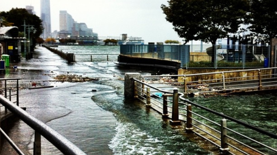 “The Hudson River has breached it’s banks 8.53 am” by Nigel Barker.
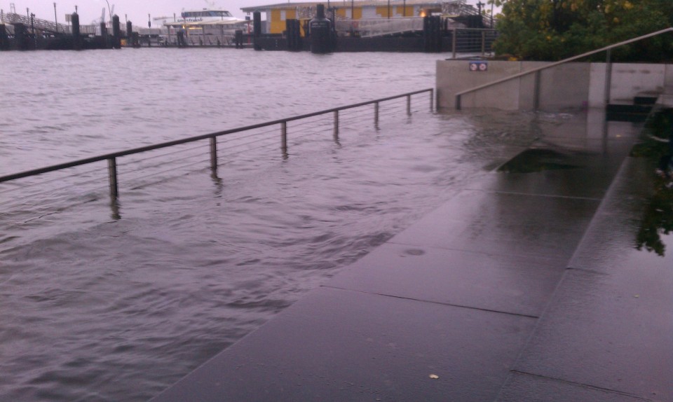 “East River rises above last two steps of Get Down, and approaches 3rd, at end of Wall Street” by Arturas Rosenbacher.
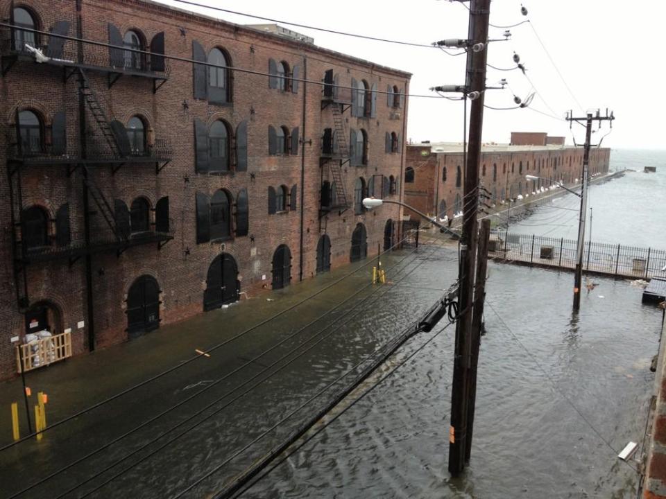 “Here we are marooned in Red Hook, Brooklyn!!” by Greenpainting.
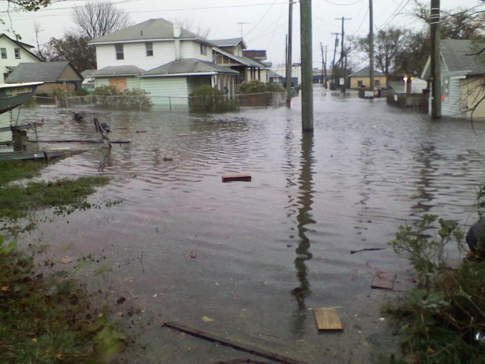
“The flooding in the Jamaica Bay, Queens neighborhood of Meadowmere. Courtesy of Kim Zatto, bait purveyor” by Corey Kilgannon.
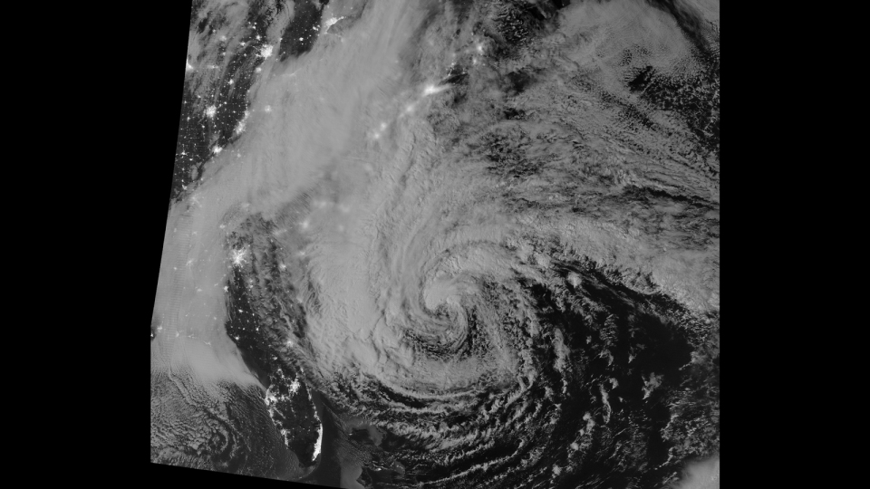
Update 15: NASA’s night shot, acquired by the Visible Infrared Imaging Radiometer Suite (VIIRS) on the Suomi NPP satellite around 2:42am EDT.
Update 14: NPR just reported that Starbucks have closed all its locations in NYC. How’s that for a disaster? They also say this may be the biggest storm ever in the region.
Update 13: If you think Sandy is going to be just another Irene fizzle, think again; this animated GIF shows just how much stronger Sandy is at this stage in the game. And it’s only getting stronger.
Update 12: Latest NOAA update keeps keeps the same prediction—it’s expected to turn northwest and west-northwest later today. NOAA says that it’s not going to weaken and, worse, “a little strengthening is possible.”
Update 11: Latest NOAA warning as of 8:00am EDT
SANDY NOW MOVING NORTH-NORTHWESTWARD AND ACCELERATING… AT 800 AM EDT…1200 UTC…THE CENTER OF HURRICANE SANDY WAS LOCATED NEAR LATITUDE 36.8 NORTH…LONGITUDE 71.1 WEST. SANDY IS NOW MOVING TOWARD THE NORTH-NORTHWEST NEAR 20 MPH…32 KM/H. A TURN TOWARD THE NORTHWEST IS EXPECTED LATER THIS MORNING…FOLLOWED BY A TURN TOWARD THE WEST-NORTHWEST TONIGHT. ON THE FORECAST TRACK…THE CENTER OF SANDY WILL MOVE OVER THE COAST OF THE MID-ATLANTIC STATES THIS EVENING OR TONIGHT.
Update 10: Latest NOAA warning as of 5:00am EDT:
AT 500 AM EDT…0900 UTC…THE CENTER OF HURRICANE SANDY WAS LOCATED NEAR LATITUDE 35.9 NORTH…LONGITUDE 70.5 WEST. SANDY IS MOVING TOWARD THE NORTH NEAR 15 MPH…24 KM/H. A TURN TOWARD THE NORTHWEST IS EXPECTED TODAY…FOLLOWED BY A TURN TOWARD THE WEST-NORTHWEST TONIGHT. ON THE FORECAST TRACK…THE CENTER OF SANDY WILL MOVE OVER THE COAST OF THE MID-ATLANTIC STATES THIS EVENING OR TONIGHT.
REPORTS FROM AN AIR FORCE HURRICANE HUNTER AIRCRAFT INDICATE THAT THE MAXIMUM SUSTAINED WINDS HAVE INCREASED TO NEAR 85 MPH…140 KM/H…WITH HIGHER GUSTS.
Last image taken at 5:30AM EDT
Update 9: Full path of the storm till Monday, October 29, 12:40am
NOAA advisory at 2:00am EDT:
THE CENTER OF HURRICANE SANDY WAS
LOCATED NEAR LATITUDE 35.2 NORTH…LONGITUDE 70.5 WEST. SANDY IS
MOVING TOWARD THE NORTH NEAR 14 MPH…22 KM/H. A TURN TOWARD THE
NORTHWEST IS EXPECTED TODAY…FOLLOWED BY A TURN TOWARD THE
WEST-NORTHWEST TONIGHT. ON THE FORECAST TRACK…THE CENTER OF
SANDY WILL MOVE OVER THE COAST OF THE MID-ATLANTIC STATES THIS
EVENING OR TONIGHT.
MAXIMUM SUSTAINED WINDS ARE NEAR 75 MPH…120 KM/H…WITH HIGHER
GUSTS. SANDY IS EXPECTED TO TRANSITION INTO A FRONTAL OR WINTERTIME
LOW PRESSURE SYSTEM PRIOR TO LANDFALL. HOWEVER…THIS TRANSITION
WILL NOT BE ACCOMPANIED BY A WEAKENING OF THE SYSTEM…AND IN
FACT…A LITTLE STRENGTHENING IS POSSIBLE DURING THIS PROCESS.
SANDY IS EXPECTED TO WEAKEN AFTER MOVING INLAND.
Sunday, October 29, 2012
Update 8: “The U.S. Army Corps of Engineers North Atlantic Division is
taking action in anticipation of Hurricane Sandy”
Update 7: A full day of Sandy. Time-lapse video from 22,300 miles, from 7:15am to 6:30pm EDT.
NASA animation by Kevin Ward, using images from NOAA and the University of Wisconsin-Madison Cooperative Institute for Meteorological Satellite Studies.
Update 6: Latest NOAA warning as of 11:25PM
THIS HAS THE POTENTIAL TO BE A LARGE AND RECORD SETTING STORM, WITH WIDESPREAD WIND DAMAGE, INLAND AND COASTAL FLOODING, AND BEACH EROSION. THE COMBINATION OF THE HEAVY RAIN AND WIND WILL CREATE THE POTENTIAL FOR WIDESPREAD POWER OUTAGES AND SIGNIFICANT FLOODING. AT THIS TIME, THE MOST LIKELY TIME FRAME FOR THE WORST OF THE RAIN AND WIND LOOKS TO BE MONDAY AND TUESDAY. THIS MEANS THERE IS STILL TIME TO PREPARE.
Update 5: Last image taken at 10:25PM EDT
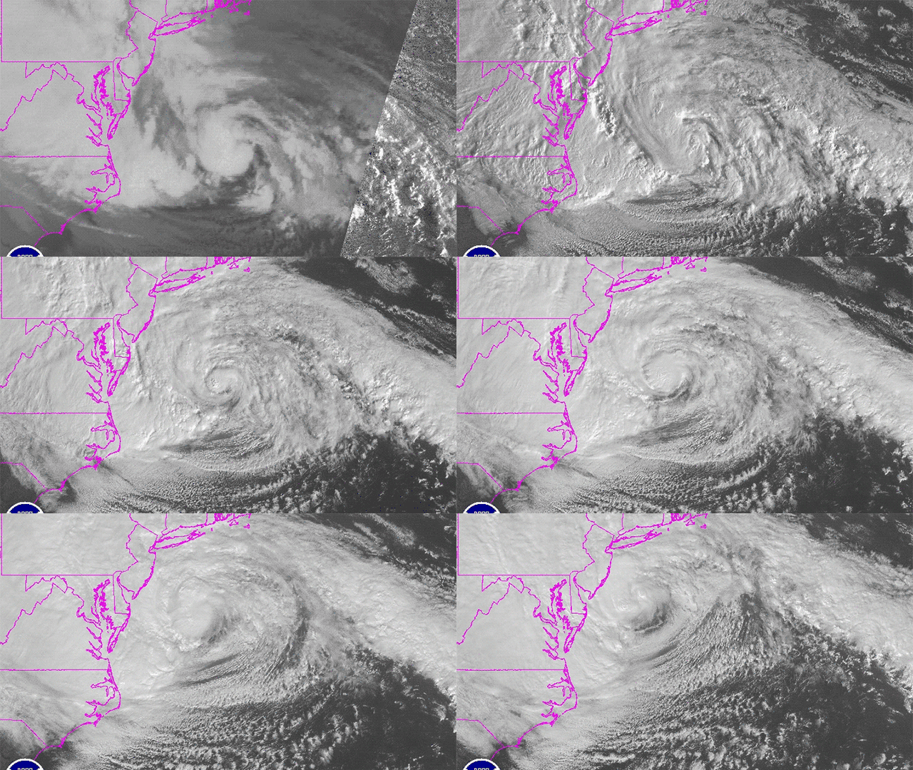
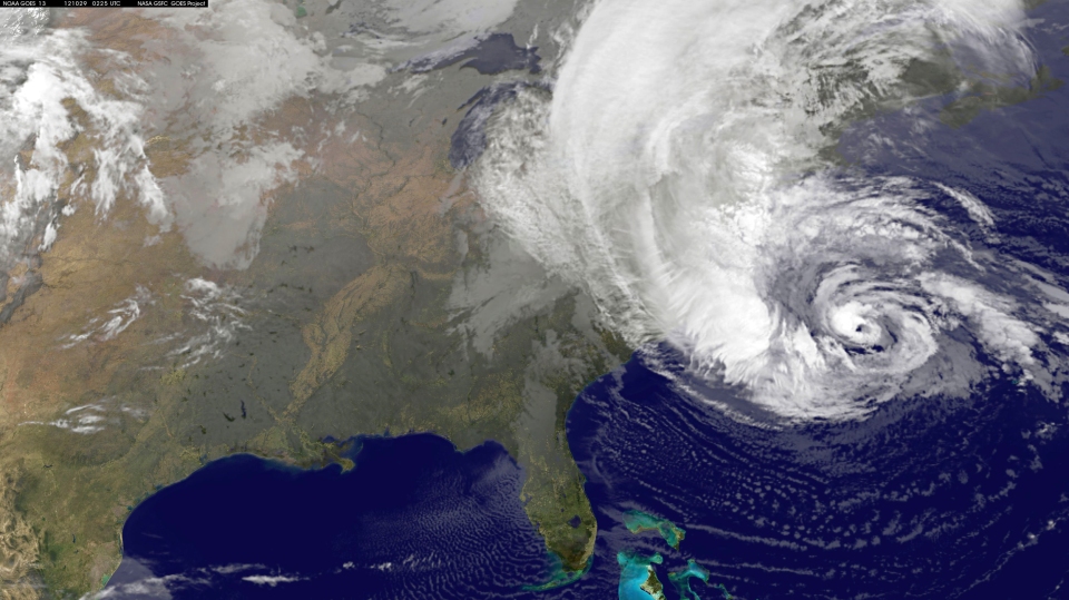
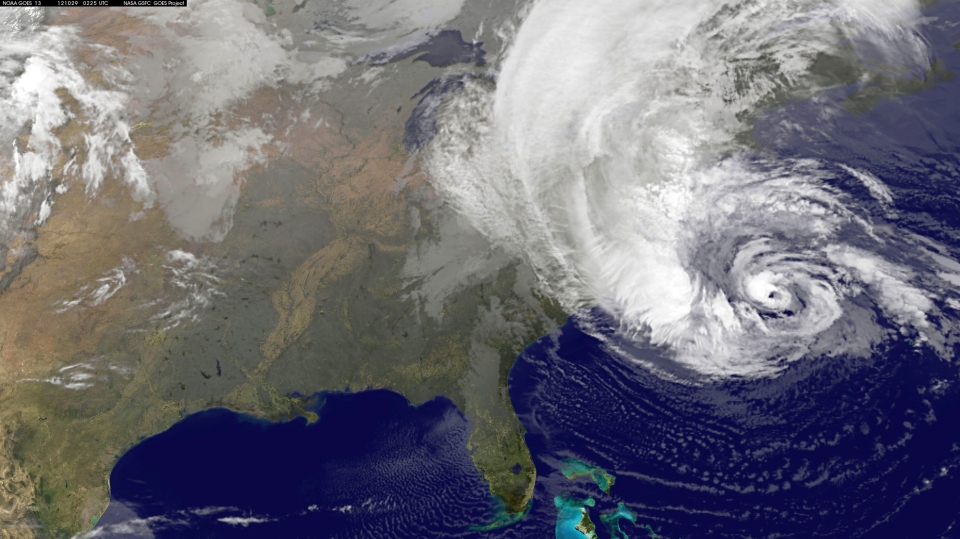
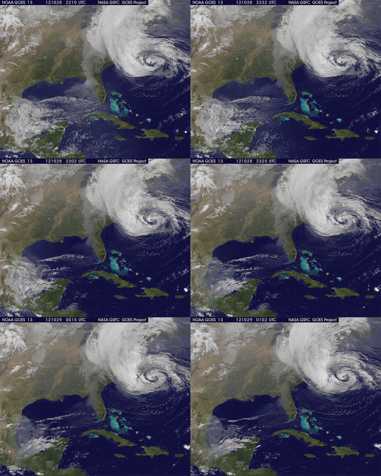
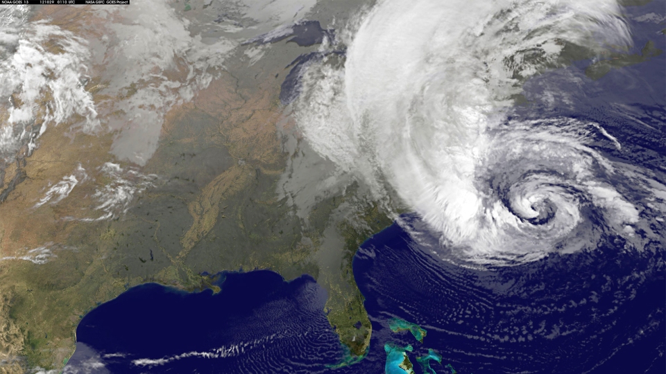
Update 4: Latest progress of hurricane Sandy taken by NASA/NOAA’s GOES-13 weather satellite from 5:10pm EDT to 9:10pm EDT.
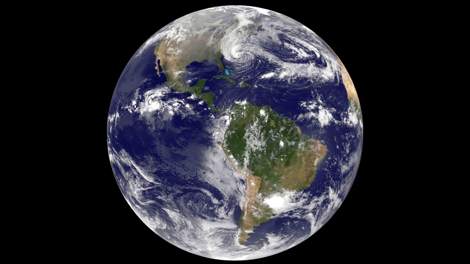
Latest image from NASA/NOAA’s GOES-13 weather satellite, taken today at 9:10pm EDT.
